3D navigation for bicycles and e-bikes

Navigation built for the bike, not borrowed from the car.

The real city in 3D, so a glance is enough: the bridge on your screen is the bridge down the road. Turns you read or just hear, a route that follows you, and your eyes back on the view.

Built for riders, not drivers.

On the road

What you see on the handlebar
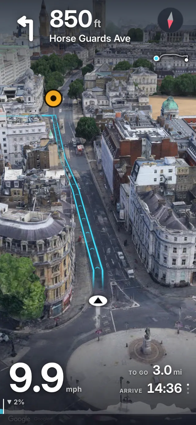
A 3D view of a London street with the route drawn along the road and a left turn 850 feet ahead
Recognise it at a glanceReal buildings, real textures. You know where you are.
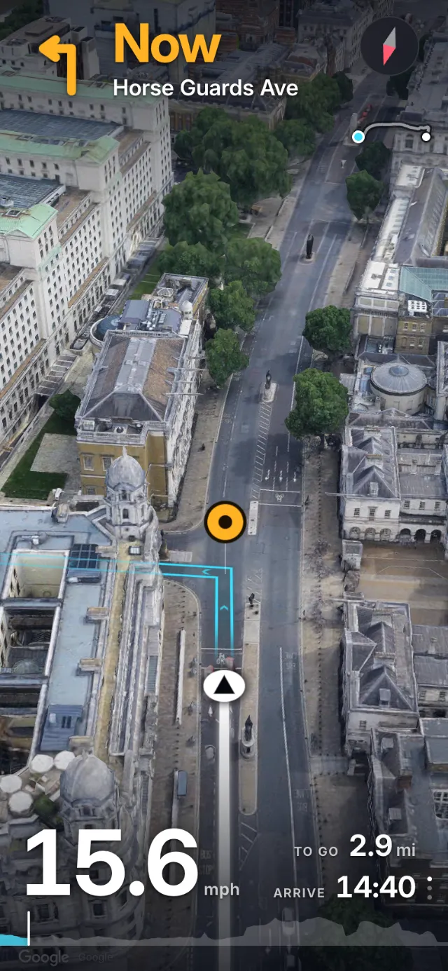
The turn cue in amber reading Now, Horse Guards Avenue, as the rider reaches the junction
Now means nowCues timed in seconds, to fit your speed.
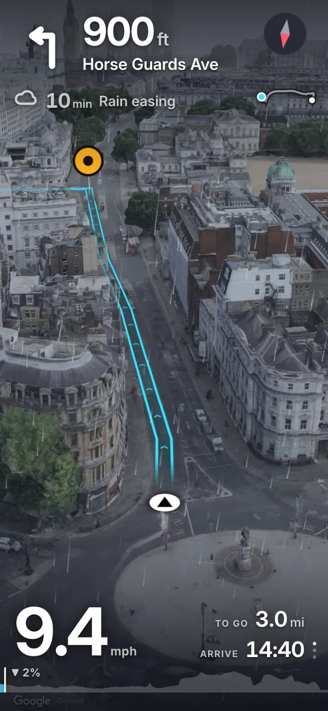
The riding screen under a grey sky with a note that the rain eases in ten minutes
Rain, ten minutes outA heads-up before the weather reaches you.
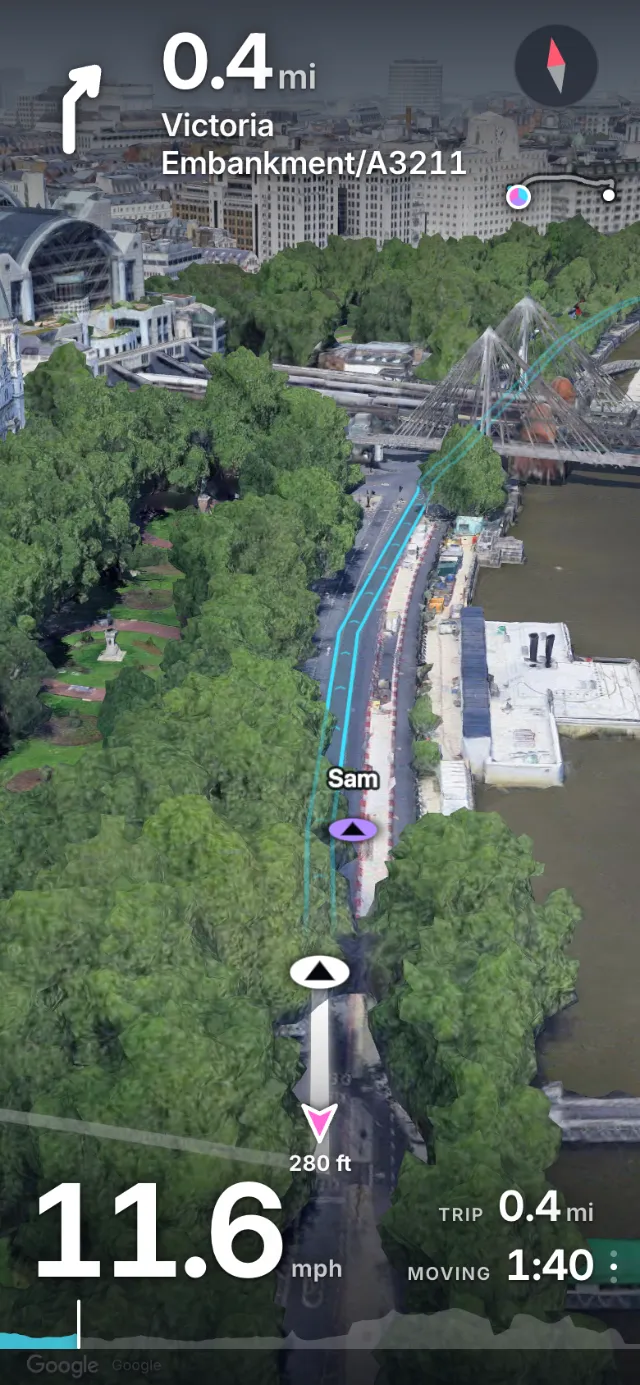
A friend named Sam shown on the route ahead along the Thames, and a pointer to another friend behind
Friends on the mapShare a link and ride together, live.
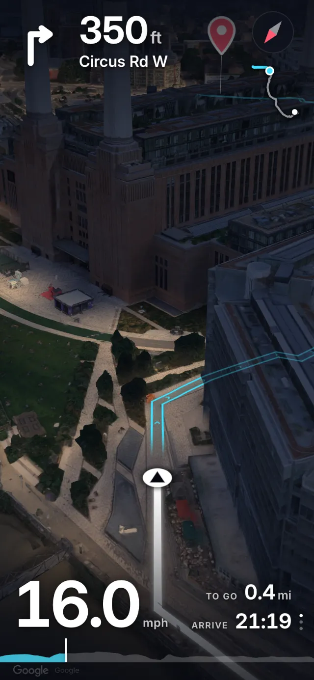
Battersea Power Station at night: the garden paths with lamps glow on the map, and everything without them stays dark

After dark

Know what is lit before you ride in

Streets with lamps glow on the map at night. A park or a wood without them stays dark, so you can tell at a glance whether your lights are up to it, or whether to go round.

The riding screen

It changes with the ride

Less when you are moving, more when you have stopped, and it follows when you leave the route. Pick a moment.

The Wend riding screen over a 3D view of Whitehall in London: a left turn in 850 feet onto Horse Guards Avenue, the route drawn on the road, speed, distance to go and arrival time

On the move it keeps to the edges: the turn, your speed, how far and when.

  1. Next turnWhich way, how far, onto what
  2. View3D ride view or flat map
  3. Whole routeWhere you are along it
  4. Turn markerThe junction, pinned in the scene
  5. RouteDrawn on the road itself
  6. YouFacing the way you ride
  7. SpeedThe one number that stays
  8. To go and arrivalAt the pace you really ride
  9. GradientThe climb ahead, and the profile
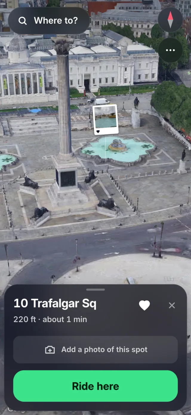
A spot pinned beside the fountain in Trafalgar Square: a small picture card stands in the 3D scene where it was pinned, with a button to add a photo of the spot

Your map

The map remembers you

Pin a spot where you stopped and leave a photo there. It stands at that place when you ride back, beside the line of every road you have ridden.

Door to door

Plan, ride, look back
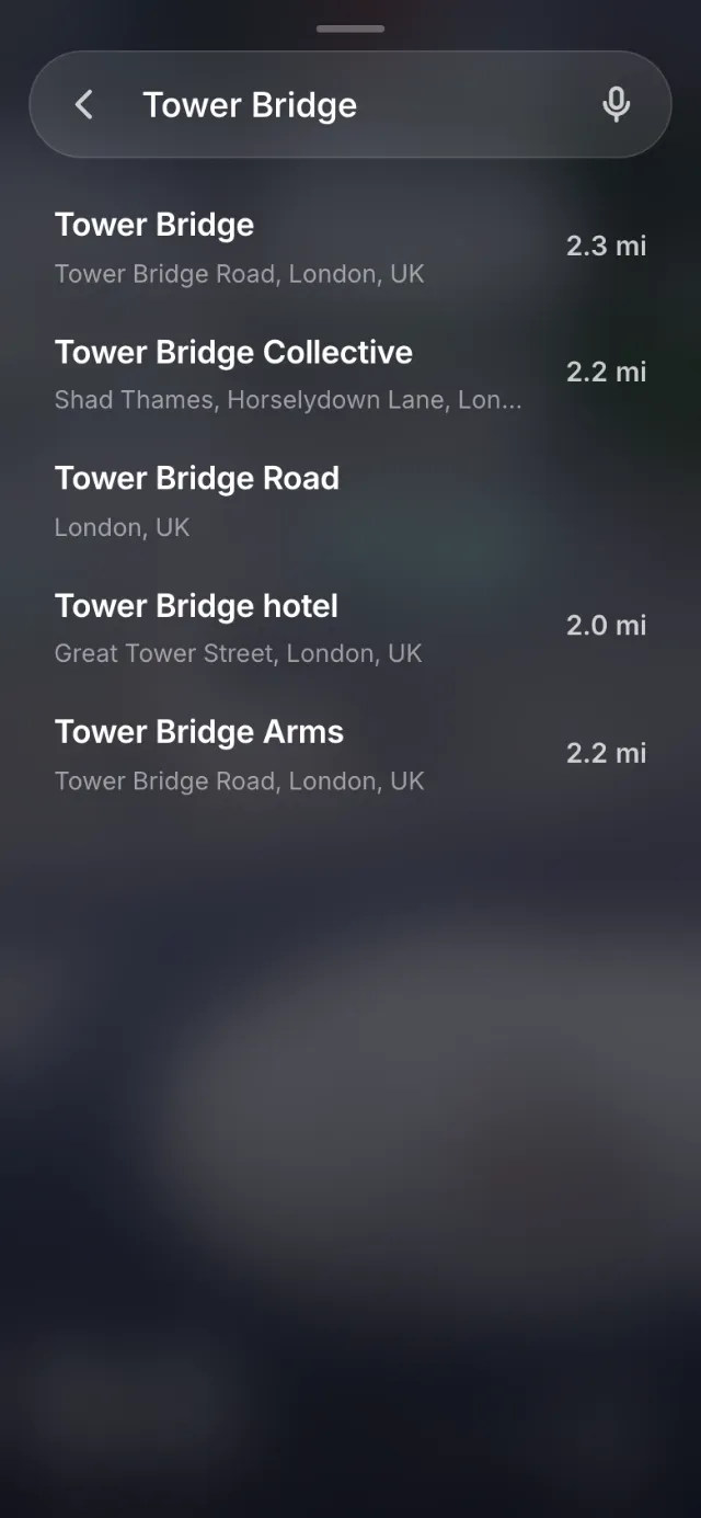
Search results for Tower Bridge with the distance to each place
1Say whereType it or speak it.
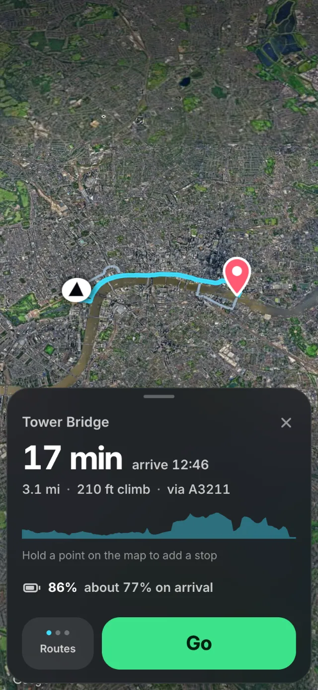
A route across London to Tower Bridge: 17 minutes, 3.1 miles, 210 feet of climbing, a climb profile, and an e-bike battery at 86% with about 77% expected on arrival
2Check the wayTime, climbs, and the battery it leaves.
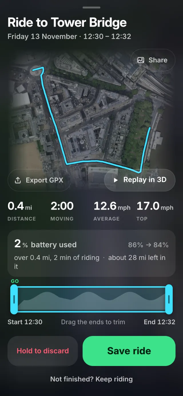
A finished ride drawn over the streets it crossed, with distance, time and speed, the battery it used, and buttons to share, export and replay
3Keep the rideShare it, export it, replay it.
Why a bike needs its own navigation

Take it for a ride

Start riding